Ground Displacement Measurement of the 2013 Balochistan Earthquake with interferometric TerraSAR-X ScanSAR data
Abstract:
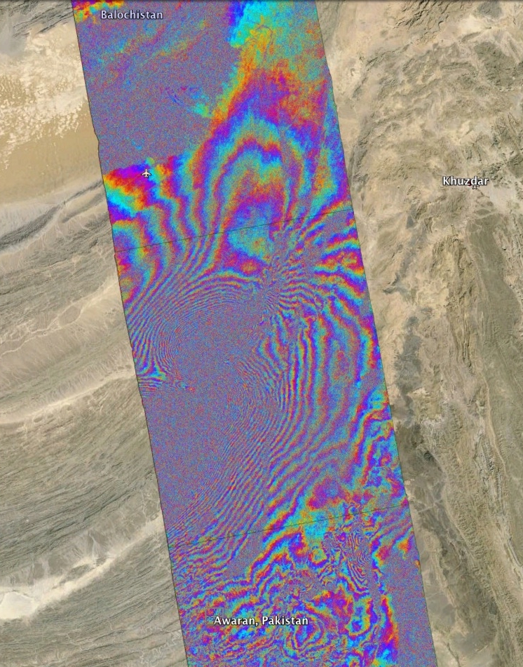
We previously derived a 3D displacement map using cross-correlation techniques applied to optical images from Landsat-8 satellite and TerraSAR-X ScanSAR amplitude images. The Landsat-8 cross-correlation measurements cover two horizontal directions, and the TerraSAR-X displacements include both horizontal along-track and slant-range (radar line-of-sight) measurements that are sensitive to vertical and horizontal deformation. It will be justified that the co-seismic displacement map from TerraSAR-X ScanSAR data may be contaminated by postseismic deformation due to the fact that the post-seismic acquisition took place one month after the main shock, confirmed in part by a TerraSAR-X stripmap interferogram (processed with conventional InSAR) covering part of the area starting on 27 September 2013.
We have arranged the acquisition of a burst-synchronized stack of TerraSAR-X ScanSAR images over the affected area after the earthquake. It will be possible to apply interferometry to these data to measure the lower magnitude of the expected postseismic displacements. The processing of single interferograms will be discussed.
A quicklook of the wrapped differential TerraSAR-X ScanSAR co-seismic interferogram is provided in the attachment (range coverage is 100 km by using 4 subswaths).