Estimating Mangrove Canopy Height and Above-Ground Biomass in Everglades National Park with Airbone LiDAR and TanDEM-X Data.
Abstract:
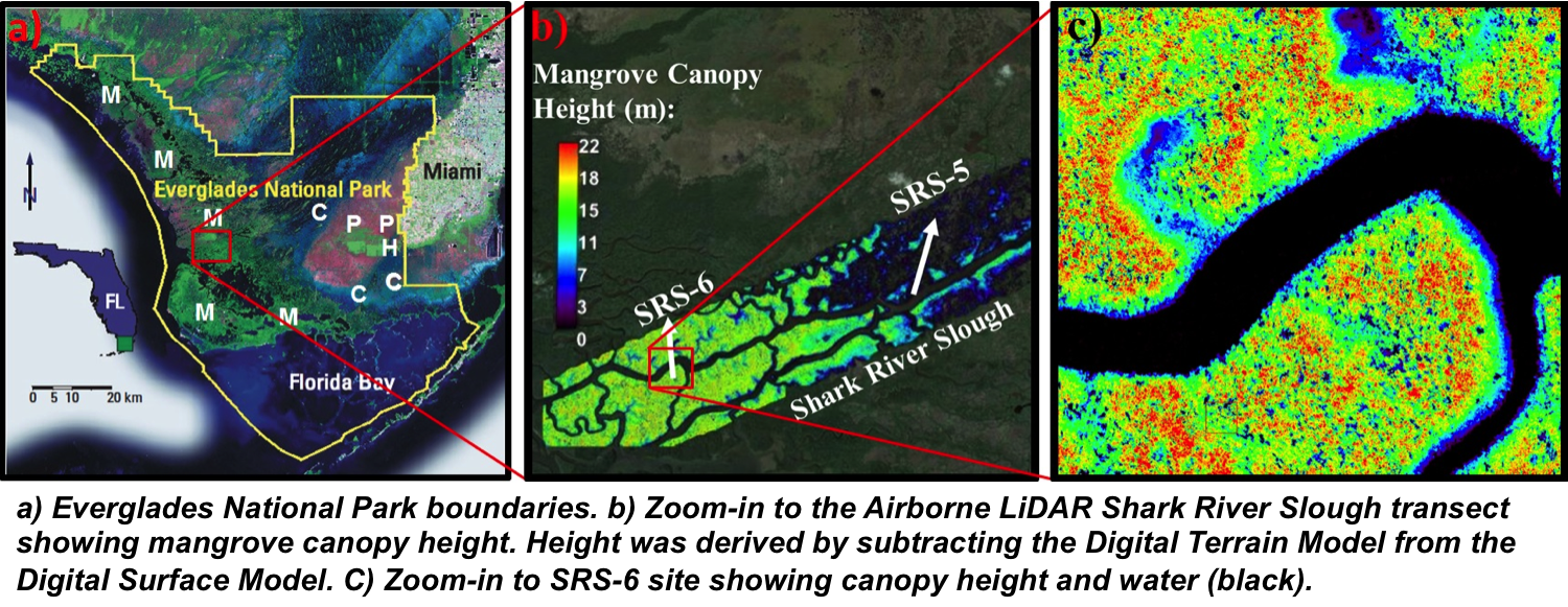
In this study we estimated canopy height and AGB using an ALS dataset acquired in 2012 and TDX data acquired during the years 2012-2014. The ALS dataset was acquired along a 16.5 x 1.5 km swath of mangrove forest with variable canopy height. The sampled areas were representative of mangrove stature and structure in the whole ENP. Analysis of the ALS dataset showed that mangrove canopy height can reach up to ~25 meters close to the coastal ENP waters. Additionally, by comparing our ALS results with those of a previous study by Simard et al. (2006) we identified areas where mangrove height changes greater than ± 3 meters occurred.
To expand the study area to the full ENP mangrove ecosystem we processed single-polarization TDX data to obtain a Digital Canopy Model (DCM) that represents the mangrove canopy height. In order to obtain the true canopy height we calibrated the TDX phase center height with ALS true canopy height. Preliminary results of a corrected single-polarized (HH) TDX scene show that mangrove canopy height can reach up to ~25 meters in the western region of the ENP.