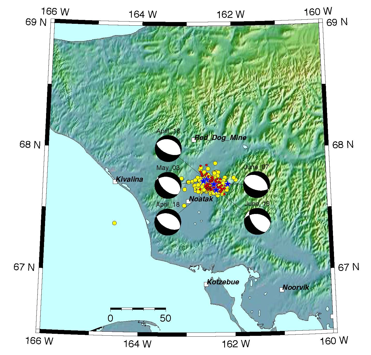
2014 Earthquake Swarm in Northwest Brooks Range, Alaska
Abstract:
Detection and reporting of these earthquakes is complicated by sparseness of seismic network in NW Alaska. At the time of April 18 earthquake the nearest seismic site was located at the Red Dog Mine, with the next nearest station 350 km away. Following the May 3 event, the Alaska Earthquake Center installed two additional temporary stations, one in Noatak and another in Kotzebue, 85 km S of the source area. Overall, 450 events were reported in this sequence through end of July. The catalog magnitude of completeness with the additional stations was about ~2.2.
We applied waveform template matching algorithm to detect additional events in this sequence that could not be detected with the standard network processing. The template matching resulted in ~600 additional event detections. The waveform cross-correlation indicates that most of the events are not repeating sources. From the catalogued events, only 6% of event pairs have correlation coefficients of 0.75 or higher. We were able to identify only a few families of repeating events. Only one family seemed to be present throughout the entire sequence, while other event families were mostly short-lived. We find preliminary evidence that the earthquakes migrated to shallower depths throughout the sequence, consistent with the observation that most event families are short-lived.
We speculate that these earthquakes are concentrated in a zone of weak crust that allows intrusion of upper mantle materials, such as fluid and volatiles. Western Alaska is characterized by extensional tectonics and accommodates a distributed plate boundary between Bering micrpolate and North American plate.