Long Term Discharge Estimation for Ogoué River Basin
Abstract:
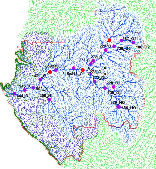
Historical data were registered during 42 years at Lambaréné (from 1929 to 1974) and during 10 to 20 years at 17 other ground stations. The quantile function approach (Tourian et al., 2013) has been tested to estimate discharge from J2 and ERS/Envisat/AltiKa virtual stations. This is an opportunity to assess long term discharge patterns in order to monitor land use change effects and eventual disturbance in runoff.
Figure 1: Ogoué River basin: J2 (red) and ERS/ENVISAT/ALTIKa (purple) virtual stations
Fichet, L. V., Sannier, C., Massard Makaga, E. K., Seyler, F. (2013) Assessing the accuracy of forest cover map for 1990, 2000 and 2010 at national scale in Gabon. In press IEEE Journal of Selected Topics in Applied Earth Observations and Remote Sensing
Tourian, M. J., Sneeuw, N., & Bárdossy, A. (2013). A quantile function approach to discharge estimation from satellite altimetry (ENVISAT). Water Resources Research, 49(7), 4174–4186. doi:10.1002/wrcr.20348