GPS-seismograms reveal amplified shaking in California’s San Joaquin Delta region
Abstract:
A total of 269 GPS stations that have high-rate (1 sps) data available were used to generate GPS-seismograms. These include stations from the Bay Area Regional Deformation (BARD) network, the Plate Boundary Observatory (PBO, operated by UNAVCO), and the USGS, Menlo Park. The Track software package was used to generate relative displacements between pairs of stations, determined using Delaunay triangulation. This network-based approach allows for higher precision than absolute positioning, because common noise sources, in particular atmospheric noise, are cancelled out. A simple least-squares network adjustment with a stable centroid constraint is performed to transform the mesh of relative motions into absolute motions at individual GPS stations. This approach to generating GPS-seismograms is validated by the good agreement between time series records at 16 BARD stations that are co-located with broadband seismometers from the Berkeley Digital Seismic Network (BDSN).
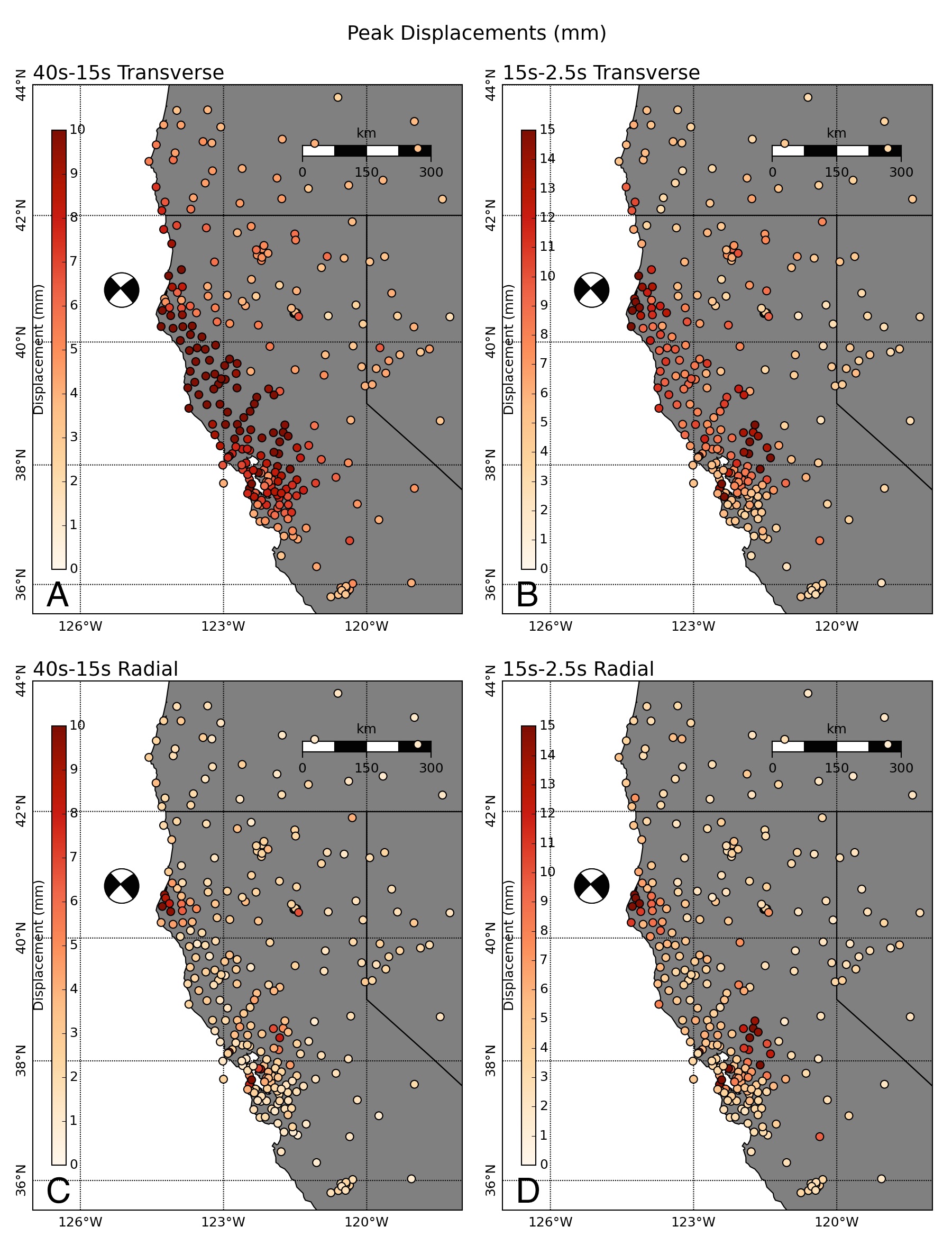
While the distribution of peak dynamic displacements is dominated in long periods by the radiation pattern, at shorter periods other patterns become visible. In particular, stations in the San Joaquin Delta (SJD) region show higher peak dynamic displacements than those in surrounding areas, as well as longer duration shaking. SJD stations also have higher dynamic displacements on the radial component than surrounding areas, implying that energy has been scattered into the radial direction within the SJD.