Using Internal Layer Deformation and Satellite-Derived Velocities to Explore the Strain History of Whillans Ice Stream, West Antarctica
Abstract:
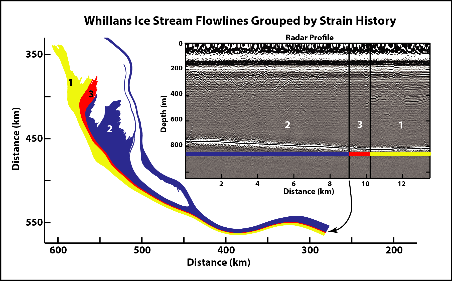
Here we use folds recorded in radar data collected on Whillans Ice Stream, West Antarctica and InSAR-derived ice-surface velocity to diagnose the causes of internal layer disruption seen in the vicinity of Subglacial Lake Whillans. We distinguish three distinct patterns of deformation of the internal stratigraphy in the radar profiles from this location: (1) smooth, continuous, and nearly flat layers; (2) layers with disrupted stratigraphy and large amplitude folds; and (3) disturbed internal stratigraphy with no coherent internal reflecting horizons. From the ice-surface velocity data, we trace flowlines from these three zones to different source areas of the ice stream (figure), indicating ice passage through three different deformation histories. We further calculate the total accumulated strain along these flowlines and compare it to the radar-depicted folding. Our results highlight the need to consider the entire flow history of the ice when inferring past ice-flow or basal conditions from internal layers. Furthermore, they indicate that inclusion of internal layer tracing and deformation algorithms into full-stress ice-sheet models should be prioritized, as internal layers offer perhaps the most detailed and spatially ubiquitous validation dataset for understanding the past state of ice sheets and their reaction to climate forcings.