Geosemantic Information Retrieval Using a Geoontology
Abstract:
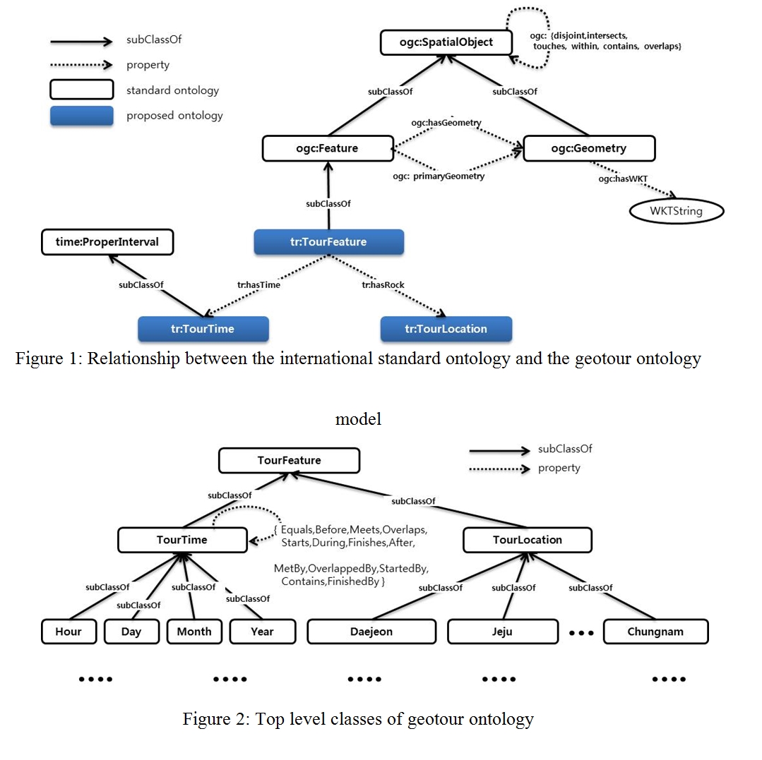
The proposed Geotour ontology model is extended and designed from W3C Time Ontology defined in the international standards and spatial geometry feature ontology supported by OGC GeoSPARQL, so it can provide the usability and the function.
That is, GeotourFeature class is the subclass of ogc:Feature defined in OGC as in Figure 1. GeotourTime class which is for expressing temporal information of a certain Geotour features is the subclass of TemporalThing of W3C.
Figure 1: Relationship between the international standard ontology and the geotour ontology model
A Geotour features and a geotour map describes a part of ontology to represent the GeotourFeature composed of GeotourTime class and GeotourLocation class. The highest class to represent GeotourTime and GeotourLocation is GeotourFeature class. As mentioned in the previous section, our model inherited the temporal ontology of W3C. Figure 2 describes a part of ontology to represent the GeotourFeature composed of GeotourTime class and GeotourLocation class. The highest class to represent GeotourTime and GeotourLocation is GeotourFeature class.
Figure 2: Top level classes of geotour ontology