Magnetotelluric and geophysical-petrophysical modelling of the Flinders Ranges lithopshere in South Australia
Abstract ID#: 36047
For upper mantle depths, induction arrows indicate the presence of a significant conductive central region within the Flinders Ranges, which has been previously identified as the Flinders Conductive Anomaly.
Significant distortion is observed in the MT responses at longer periods, most likely due to the complex deformational history of the region and topographical effects. Three-dimensional inversions were applied to the data, covering a volume of about 300 by 400 km by 200 km depth. The resistivity structure is heterogeneous to a large degree to depths of about 80 km, below which the model tends toward homogeneity.
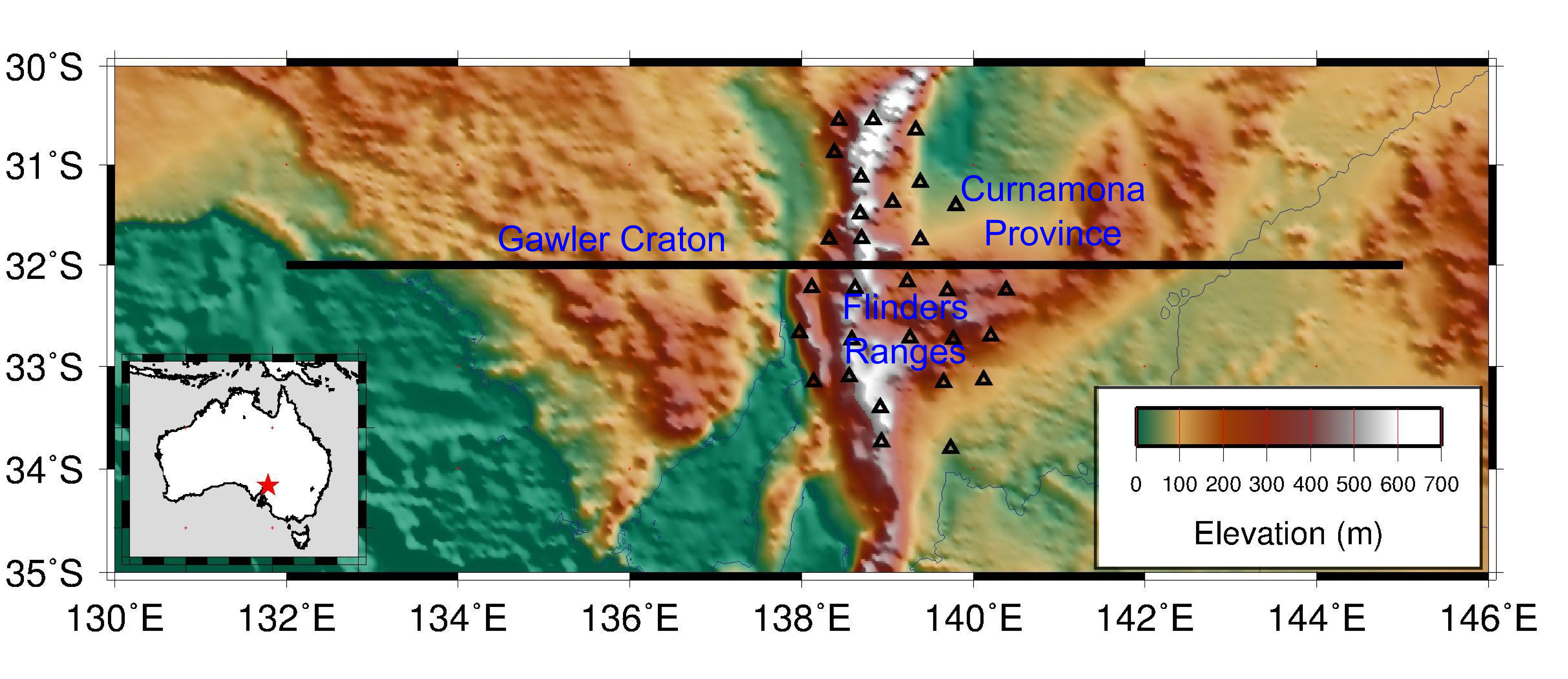
Forward modelling of a 1300 km east-west transect crossing the model region from western Eyre Peninsula into New South Wales has been conducted using the LitMod approach. Preliminary investigations suggest a four-layered surface-to-400 km depth model using a proton lithospheric composition as estimated from local xenolith data fits the average local topography and geoid data for a LAB depth of ~175 km. Future work includes testing how lithospheric mantle composition varies laterally through different provinces and how this aligns with electrical resistivity data. We also intend to investigate vertical heat production and thermal conductivity distribution within the South Australian Heat Flow Anomaly to determine the likelihood of a crustal versus upper mantle heat source.
Figure Caption:
Map of survey region with topography shown. Black triangles show long-period MT station locations and black horizontal line shows extent of transect for LitMod.