Integrating 3D Modeling, In-Situ and Remote-Sensed Observations of Flow and Sediment Dynamics in the Hau River Estuary and Shelf, Mekong Delta, Vietnam.
Jan Adriaan Roelvink, UNESCO-IHE� Institute for Water Education, Water Science and Engineering, Delft, Netherlands; Deltares, Delft, Netherlands, Johan Reyns, IHE Delft Institute for Water Education, Coastal and Urban Risk & Resilience, Delft, Netherlands; Deltares, Applied Morphodynamics, Delft, Netherlands, Robin Lydia McLachlan, University of Washington, School of Oceanography, Seattle, WA, United States, Dr. Emily F Eidam, Oregon State University, College of Earth, Ocean, and Atmospheric Sciences, Corvallis, United States, Paul Liu, North Carolina State University, Department of Marine, Earth, and Atmospheric Sciences, Raleigh, United States, Andrea S Ogston, University of Washington, School of Oceanography, Seattle, United States, Thanh Quoc Vo, UNESCO-IHE Institute for Water Education, Delft, Netherlands and Chris Wackerman, Radiant Solutions, Ypsilanti, MI, United States
Abstract:
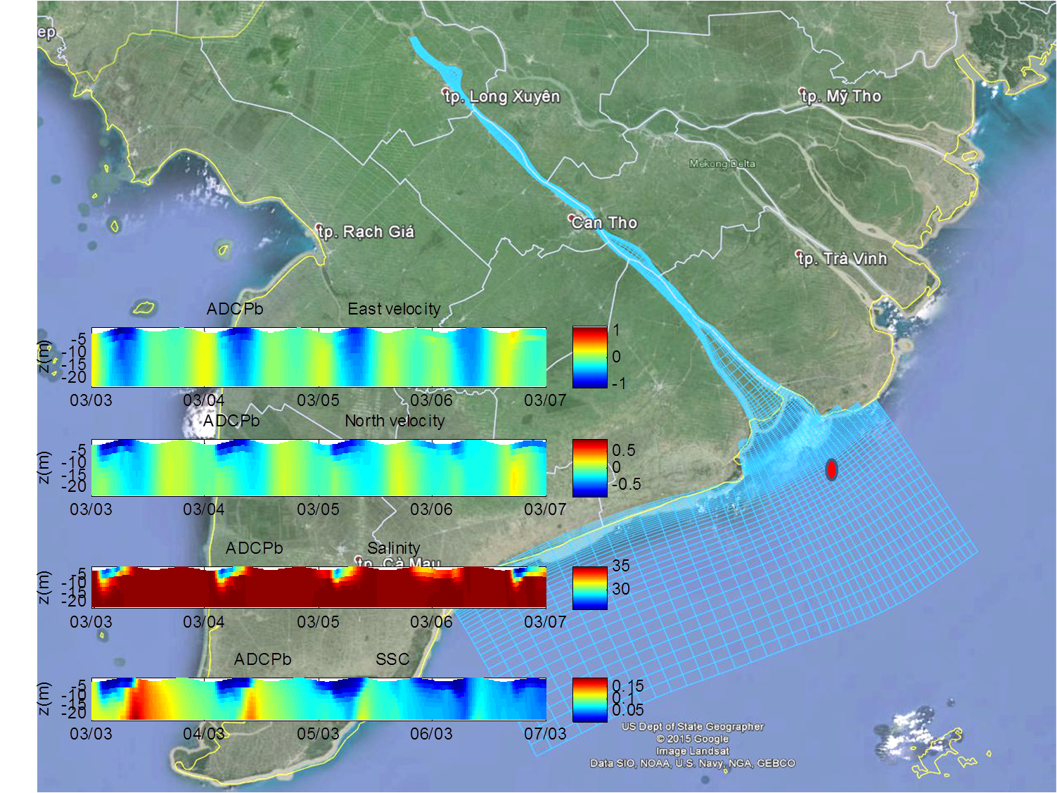
This paper aims at connecting sparse in-situ and remote-sensed observations using 3D modeling in order to create a temporally and spatially more complete picture of the 3D hydrodynamic and sediment processes in the Hau river branch of the Mekong delta estuary, Cu Lau Dung island and the shelf. A Delft3D model was set up with a domain extending upstream to 155 km from Cu Lau Dung and approx 150 km alongshore towards the souhwest. The model was set up with a deliberately coarse grid to be able to quickly assess the dominant processes. Since the underlying bathymetry data is much finer it is relatively straightforward to refine the model according to needs. The model has 10 equidistant sigma layers and can run, including salinity and sediment processes, a spring-neap cycle in little more than an hour on a laptop, making it very suitable for a first assessment of processes and sensitivities to input parameters and forcing conditions. The model was used successfully during the final workshop of the ONR Mekong delta programme to facilitate the connection between modeling and observations. Resulting collaborative results will be presented at the conference, connecting ADCP data on fixed moorings, ADCP and CTD profiles from ships in Bassac and on the shelf, with RS images of SSC. The modeling will be used to gain understanding on the sediment exchange processes between the tidal river and estuary; between the different branches of the Song Hau; between the channels and the shelf and between the outflow plume and the shelf bottom. Detailed simulations over the periods of the fieldwork will be used for model validation, and longer-term simulations covering full years will be used to provide a spatio-temporal context and first attempts at extrapolating towards geological scales. Acknowledgements This study was funded by ONR under Grant N00014-12-1-0433 Modeling the Mekong Delta at three different scales