Instability of thin, freshwater layers in the Bay of Bengal
Instability of thin, freshwater layers in the Bay of Bengal
Abstract:
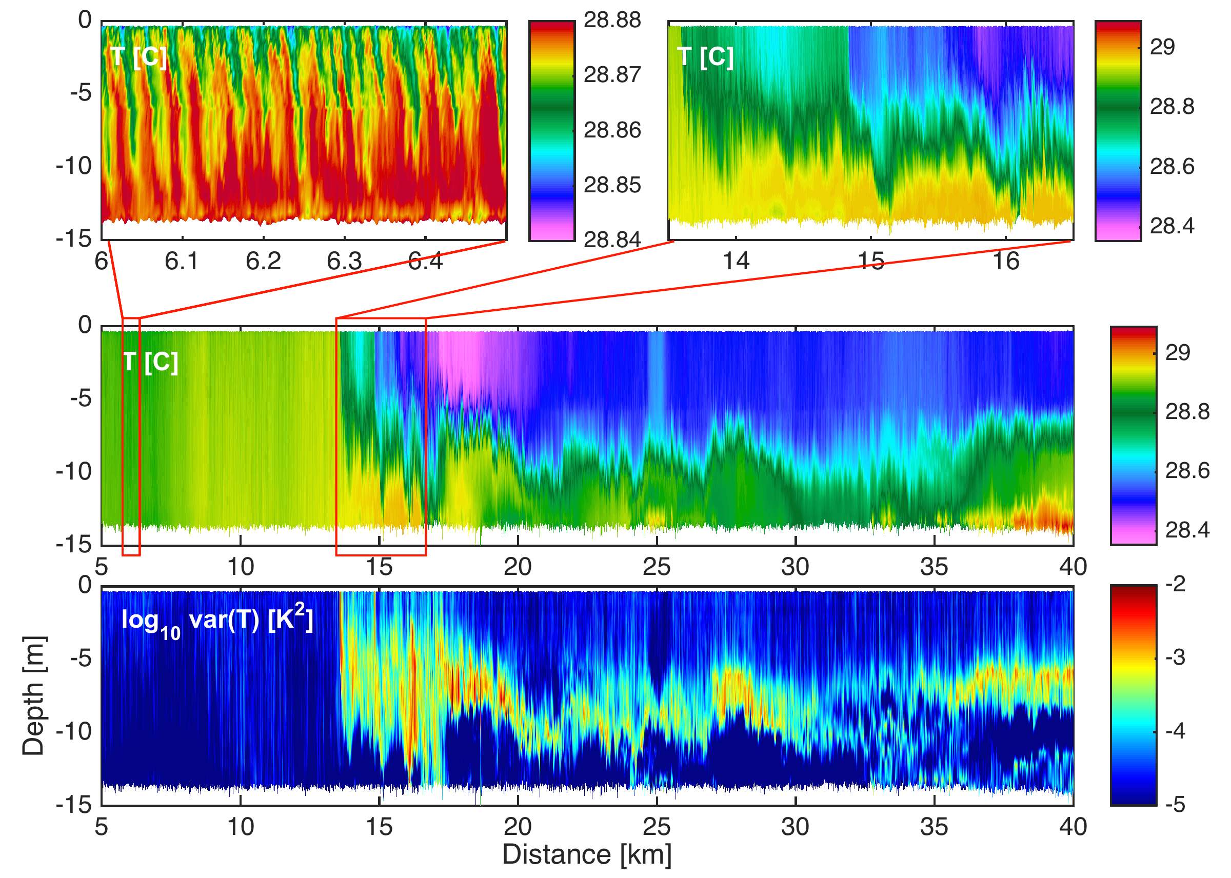
Heavy precipitation and high river flow in the northern Bay of Bengal creates extremely thin freshwater layers that trap heat and alter air-sea fluxes. During the 2015 summer monsoon, an intensive joint US-Indian effort was undertaken to understand the horizontal and vertical dispersion of these layers. Within that program, repeat surveys of the very near surface velocity and stratification were simultaneously obtained by 2 ships and a remotely operated kayak, obtaining data with 1-m horizontal and vertical resolution of a large-scale front that remained persistent over several inertial periods. Here we focus on details of the frontal structure in the upper 10 m, exploring (i) the turbulence and instabilities with horizontal scales of 20-2000 m that act to diffuse it, and (ii) larger scale convergence that acts to maintain it. We will try to understand the factors that differentiate periods of intense instability from periods without.